Geolocating an Island with Geometry and CUDA
Key Takeaways
- •The challenge was solved by converting a photo into a geometric fingerprint and matching it against global landmasses.
- •CUDA parallelism enabled tens of millions of triangle tests to run quickly enough for a globe-scale search.
- •Heuristic filters such as tropical latitude, cluster density, and shape checks drastically reduced false positives.
- •The final identification relied on combining geometry with vegetation, elevation, and visual inspection.
Technical Specifications & Data
| Problem Type | OSINT image geolocation of an unknown island resort |
| Primary Method | Geometric fingerprinting from three visible landmasses |
| Search Space | Global land polygons filtered to tropical regions |
| GPU Technique | CUDA parallel evaluation of one triangle triple per thread |
| Candidate Volume | 80.7 million triples tested in parallel |
| Cluster Cap | 60 points per cluster to limit combinatorial growth |
| Combinatorial Example | A 60-point cluster yields 34,220 unique triples |
| Key Filters | Tropical band, density clustering, area ordering, angle/ratio tolerances, vegetation, elevation, shape heuristics |
| Metadata Availability | No useful EXIF or GPS data |
| Final Shortlist | 26 candidates |
| Final Identification | Oan resort, Micronesia |
| Camera Direction | Northwest |
How the Island Search Worked
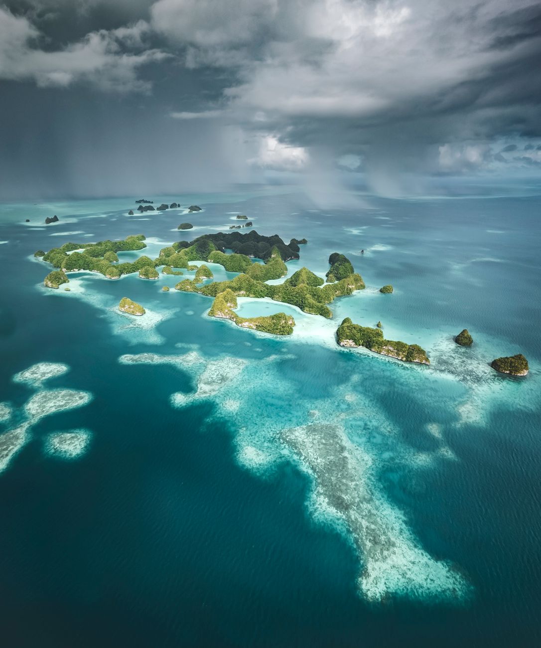
The core idea was to turn a single photo of an island resort into a searchable geometric signature. The solver first extracted three visible landmasses from the image and treated them as a triangle fingerprint, using relationships such as angles, side lengths, and area ratios rather than trying to compare the entire photograph directly. That matters because geometric invariants survive scale changes and camera distance, making them ideal for visual geolocation.
From there, the search space was reduced using terrain-aware filters. OpenStreetMap land polygons were constrained to tropical regions, then filtered by local point density so that only plausible island clusters remained. Each remaining cluster generated many 3-point combinations, and the combinations were checked against the fingerprint. A reported 80.7 million candidate triples were evaluated in parallel on the GPU, showing why CUDA is a natural fit for this kind of brute-force spatial matching.
The article’s value is that it demonstrates a practical workflow for OSINT and image geolocation: start with robust shape descriptors, add cheap geographic pruning rules, then reserve expensive validation for the final shortlist. That sequence is far more scalable than visually scanning maps by hand, especially when the target is a small, unfamiliar island in a large archipelago.
Why This Matters & Unique Technical Insights
This case is more than a clever puzzle solution; it is a compact example of how computer vision, GIS, and GPU compute can be fused into a high-throughput search pipeline. The unique insight is that the solver did not rely on a single “magic” detector. Instead, the method stacked multiple weak signals: triangle geometry, shoreline compactness, coral-cay heuristics, vegetation presence, elevation cues, and directional reasoning about the camera’s heading. Each stage eliminated a different class of false positives.
A particularly important detail is the use of a tolerance-window strategy. Real-world photos are noisy: perspective distortion, imperfect clicks, map simplification, and coastline irregularities all introduce error. By allowing bounded variation in angle, ratio, and side-length measurements, the pipeline remains robust without becoming so loose that it matches everything. The GPU then becomes a force multiplier, because the search is embarrassingly parallel once each triple can be evaluated independently.
The approach also hints at a broader pattern used in defense and navigation systems: terrain contour matching. In that context, geometry is not just a convenience; it is a reliable feature family when metadata is absent. For OSINT practitioners, the lesson is clear: combining human intuition with spatial indexing and parallel compute can collapse a seemingly impossible open-world search into a tractable shortlist.
Technical Specifications and Search Parameters
The workflow can be summarized as a staged candidate-reduction system. First, the image had no useful EXIF or GPS metadata, so the search had to begin from visible scene structure alone. Next, land candidates were limited to the tropics before geometry-heavy processing began. Then, nearby points were grouped into clusters, and clusters were capped at 60 points to control combinatorial explosion. This cap is critical because 60 points already produce 34,220 unique triples.
The GPU stage evaluated 80.7 million triples, a scale that would be impractical for a purely serial implementation. Each triple was assigned a CUDA thread, sorted by land area to identify the likely islet, and checked against tolerance ranges for angle, size, separation, and side lengths. After that, later filters handled domain-specific realism: one check looked for an open rectangular layout, another for compact coral-cay shape, another for an oval-like silhouette, plus NDVI vegetation and elevation checks. These filters turned a broad geometric match into a geographically plausible island location.
The final shortlist reportedly narrowed to 26 candidates before visual inspection. The winning location was identified as Oan resort in Micronesia, with the camera facing northwest. For readers building similar systems, the most transferable lesson is that the key performance variable is not just GPU speed, but how effectively each heuristic reduces the candidate set before the expensive pairwise or triplewise search begins.
Build faster geospatial search pipelines with GPU-accelerated compute and GIS tooling.
Chronological Timeline
The solver began with a resort-island photo lacking useful metadata, forcing a purely visual and geometric approach.
Three visible landmasses were converted into a triangle-based signature using angle, distance, and area relationships.
OpenStreetMap land polygons were restricted to tropical regions and grouped into local clusters.
Around 80.7 million triangle candidates were evaluated in parallel on the GPU.
Shape, vegetation, and elevation filters reduced the candidate set to a small shortlist.
The correct location was confirmed as Oan resort in Micronesia, with the camera facing northwest.
Frequently Asked Questions
Why use triangles for island geolocation?
Why was CUDA useful here?
What reduced the search space the most?
What made the final match trustworthy?
Daily Specs Editorial Staff
Lead Technical Analyst & Hardware Researcher
The Daily Specs editorial staff compiles, benchmarks, and verifies emerging technical specifications directly from system architecture manuals, hardware datasheets, and open-source codebases to deliver high-gain technical intelligence.