Hurricane Dynamics: Technical Specs & Predictive Science
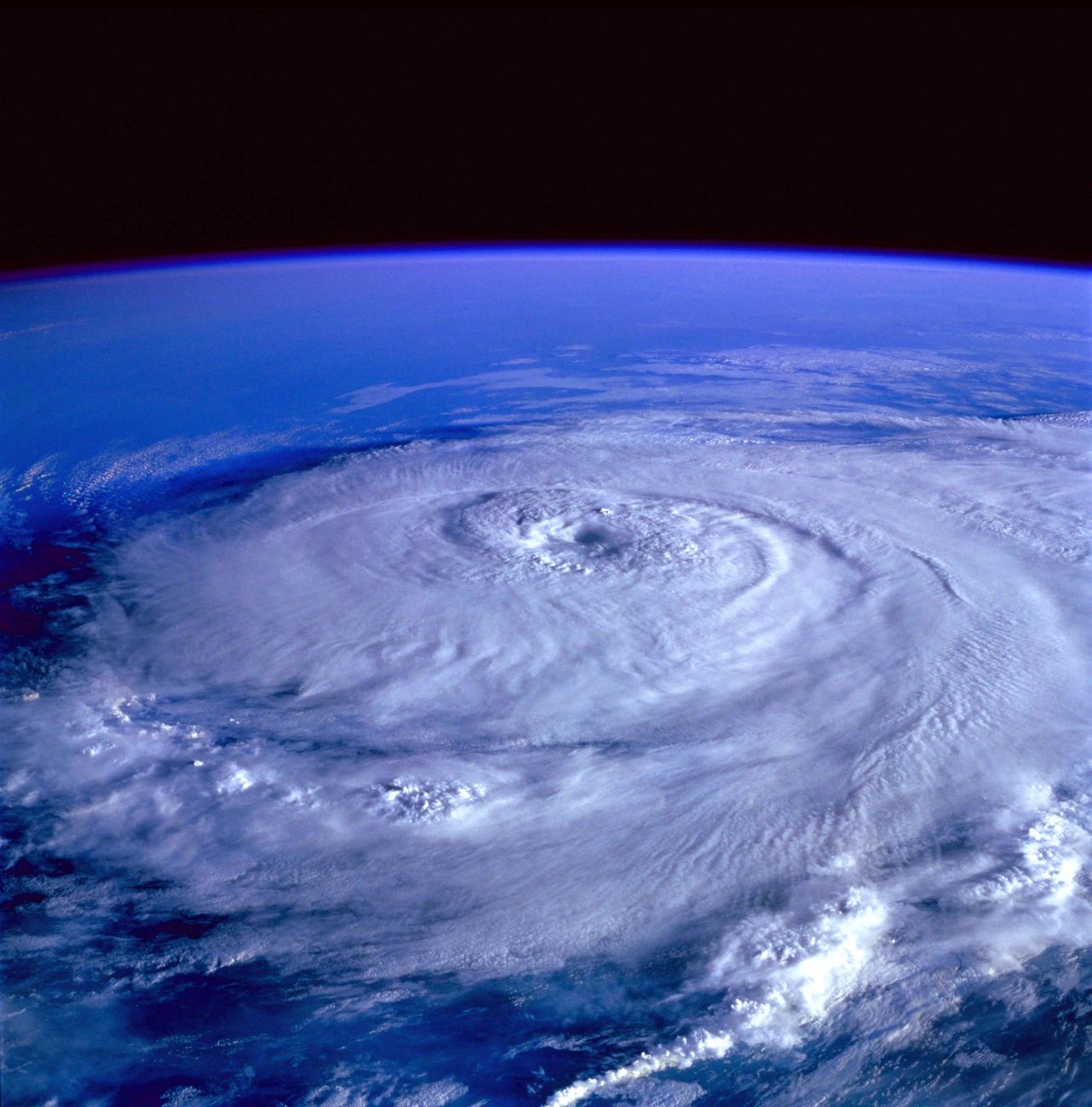
Key Takeaways
- •Hurricanes are categorized by the Saffir-Simpson Scale, correlating wind speed with potential damage and providing crucial technical parameters.
- •Advanced atmospheric and oceanic modeling, combined with real-time sensor data, is critical for precise hurricane prediction and tracking.
- •Understanding the energy dynamics, such as latent heat release and oceanic heat content, is key to forecasting hurricane intensification.
- •Engineering resilience strategies leverage precise meteorological data to mitigate the impact of extreme wind, pressure, and storm surge.
Technical Specifications & Data
| Saffir-Simpson Cat 1 Wind Speed | 74-95 mph (119-153 km/h) |
| Saffir-Simpson Cat 5 Wind Speed | >157 mph (>252 km/h) |
| Saffir-Simpson Cat 5 Min Central Pressure | <920 mbar (hPa) |
| Typical Ocean Heat Content for RI | >26.5°C in upper 50m |
| Typical Hurricane Energy Release Rate | 10^13 - 10^14 Watts |
| Geostationary Satellite Altitude | ~35,786 km (22,236 miles) |
| Doppler Radar S-band Wavelength | 7.5-15 cm |
The Saffir-Simpson Scale & Its Technical Parameters
The Saffir-Simpson Hurricane Wind Scale is the primary technical standard used to classify hurricanes based on their sustained wind speeds, providing a direct correlation to potential property damage. This scale ranges from Category 1 to Category 5, each with specific wind speed thresholds. For instance, a Category 1 hurricane sustains winds between 74-95 mph (119-153 km/h), while a catastrophic Category 5 storm boasts winds exceeding 157 mph (252 km/h). While initially developed to estimate potential storm surge and central pressure, the scale is now primarily a wind-speed index.
Technically, central pressure measurements (often in millibars) are critical but are not direct components of the *official* Saffir-Simpson classification; however, lower central pressures generally correlate with higher wind speeds. Storm surge, another devastating aspect, is not directly included in the scale's categorization due to its high variability influenced by bathymetry, coastline geometry, and forward speed. These parameters—wind speed, central pressure, and storm surge—are continuously monitored and refined through a combination of reconnaissance aircraft (e.g., 'Hurricane Hunters' deploying dropwindsondes), advanced Doppler radar, and satellite imagery, providing the raw data for technical assessments and disaster preparedness.
Advanced Predictive Modeling & Monitoring Technologies
Modern hurricane forecasting relies on sophisticated numerical weather prediction models that integrate vast datasets from various sources. Key global and regional models, such as the Global Forecast System (GFS) and the European Centre for Medium-Range Weather Forecasts (ECMWF), utilize complex atmospheric physics and fluid dynamics equations to simulate hurricane genesis, track, and intensity. Ensemble forecasting, where multiple model runs are initiated with slightly perturbed initial conditions, provides a probabilistic range of outcomes, significantly enhancing forecast confidence and risk assessment.
Monitoring technologies are equally critical. Doppler weather radar systems operate across S-band (long-range, less attenuation) and C-band (medium-range) frequencies, providing detailed precipitation and wind shear data near coastlines. Weather satellites, both geostationary (e.g., NOAA's GOES series at ~35,786 km altitude) and polar-orbiting (e.g., NASA/NOAA satellites at ~700-800 km altitude), offer continuous, wide-area surveillance, capturing visible, infrared, and microwave imagery. These sensors detect sea surface temperature anomalies, cloud top temperatures, and water vapor distribution – all vital inputs for initializing and validating predictive models and identifying regions ripe for tropical cyclogenesis.
Why This Matters & Unique Technical Insights
The granular technical specifications of hurricanes are paramount for engineering resilient infrastructure, informing urban planning, and executing effective emergency response. Unique insights emerge when linking specific atmospheric and oceanic parameters to a hurricane's behavior. For instance, 'oceanic heat content' – the amount of heat energy stored in the upper layers of the ocean – is a more precise predictor of rapid intensification than just sea surface temperature. A deep layer of warm water (above 26.5°C/80°F in the upper 50 meters) provides a substantial energy source that can fuel intense convection even as the storm mixes cooler water from below, a critical factor often overlooked in basic analyses.
From an engineering perspective, understanding the precise wind load parameters from Category 3-5 hurricanes dictates building codes for roof attachments, window specifications, and overall structural integrity. Storm surge modeling, which integrates bathymetry, tide levels, and atmospheric pressure, allows for the design of elevated structures and protective barriers. Furthermore, the sheer energy dissipation of a mature hurricane can exceed the entire world's electricity generating capacity, a testament to the immense power conversion from latent heat release. Advanced atmospheric models are continually being refined to resolve smaller-scale processes like eyewall replacement cycles and mesovortices, which significantly impact a storm's intensity and could lead to more accurate 24-48 hour intensity forecasts, crucial for targeted evacuations and asset protection.
Strengthen your home's resilience: Explore top-rated hurricane shutters and emergency generators for optimal preparedness.
Chronological Timeline
Initial development of rudimentary hurricane tracking and warning systems, primarily based on ship reports.
U.S. introduces the alphabetical naming convention for hurricanes, standardizing communication.
Development and implementation of the Saffir-Simpson Hurricane Wind Scale (officially adopted in 1973).
Significant advancements in satellite meteorology and numerical weather prediction (NWP) models, improving track forecasts.
Refinement of high-resolution hurricane models, widespread use of ensemble forecasting, and integration of AI/ML for intensity prediction.
Frequently Asked Questions
What is the primary difference between a hurricane, typhoon, and tropical cyclone?
How do scientists measure a hurricane's strength beyond wind speed?
What role does sea surface temperature play in hurricane formation?
Daily Specs Editorial Staff
Lead Technical Analyst & Hardware Researcher
The Daily Specs editorial staff compiles, benchmarks, and verifies emerging technical specifications directly from system architecture manuals, hardware datasheets, and open-source codebases to deliver high-gain technical intelligence.